Urbex Map Alabama – Urban Exploration
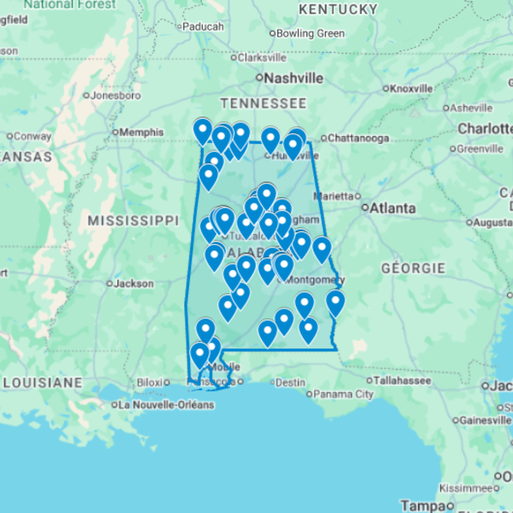
The Urbex Map Alabama is a detailed and structured abandoned places map covering the entire state of Alabama. It compiles 86 verified urban exploration spots into a practical and easy-to-use GPS file format. Instead of spending hours searching through outdated forums, scattered coordinates, or unreliable online sources, this urban exploration map centralizes essential location data into one organized digital database. Each entry helps explorers quickly identify potential abandoned buildings and plan photography sessions or exploration routes efficiently.
This urbex map includes a wide range of urban exploration spots such as industrial sites, former public buildings, forgotten infrastructure, and historic properties. By using a structured GPS map, explorers can significantly reduce research time and organize their exploration routes more effectively.
For urban explorers, photographers, filmmakers, and content creators, having a reliable abandoned places map of Alabama provides a valuable advantage for planning documentary work and visual storytelling.
Cities & Regions Included
- Birmingham & Central Alabama : Birmingham and its surrounding counties contain numerous abandoned steel mills, factories, and industrial plants from the region’s historic iron and steel industry. These large-scale sites offer dramatic interiors filled with decaying machinery and industrial architecture.
- Mobile & Gulf Coast : The Mobile area and Gulf Coast feature former warehouses, dockside structures, and coastal industrial buildings tied to the region’s maritime and shipping history. Many locations show significant weathering from decades of Gulf Coast humidity and storms.
- Montgomery & Black Belt : Montgomery and the surrounding Black Belt region include former plantations, decaying institutional buildings, and historic downtown structures. These locations reflect deep layers of history and offer striking architectural details.
- Northern Alabama & Tennessee Valley : The Tennessee Valley and northern Alabama feature abandoned textile mills, rural farmsteads, and former industrial sites from the early 20th century. Many are set within scenic landscapes combining industrial decay and natural overgrowth.
Types of Spots Included
This urbex map includes a wide variety of abandoned locations such as hospitals, factories, warehouses, mansions, schools, hotels, industrial plants, office buildings, transportation facilities, and former institutional buildings. Some entries feature large industrial complexes, while others highlight smaller forgotten buildings with historical or architectural significance. The diversity of locations provides excellent opportunities for photography, filming, and urban exploration documentation.
Why Choose This Urbex Map?
✔️ Verified and organized abandoned locations
✔️ Structured digital GPS format
✔️ Instant access after purchase
✔️ Saves extensive research time
✔️ Large structured database (86 spots)
✔️ Designed for serious urban explorers and content creators
Technical Specifications
- File Format: .KML / .KMZ
- Instant Digital Download
- Compatible with Google Earth
- Compatible with Google My Maps
- Works on Desktop & Mobile Devices
- Digital Product Only (No physical item shipped)
How to Install
- Complete your purchase and download the .KML or .KMZ file.
- Open Google Earth or go to Google My Maps in your browser.
- Import the downloaded file into the platform.
- Browse the GPS locations and plan your exploration routes.
Installation takes less than two minutes and works on both desktop and mobile platforms.


Reviews
There are no reviews yet.