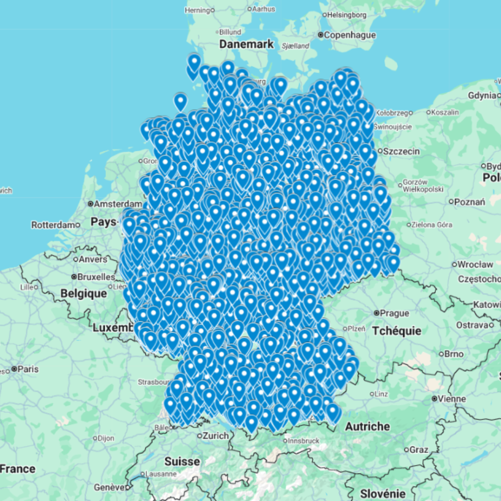
Urbex Map Germany – Urban Exploration GPS Map
The Urbex Map Germany is a detailed and structured abandoned places map covering the entire country. It compiles 9,338 verified urban exploration spots into a practical and easy-to-use GPS file format designed for efficient exploration planning. Instead of spending countless hours searching through scattered coordinates, outdated forums, or unreliable sources, this urban exploration map brings together essential location data into one organized digital database. Each entry helps explorers quickly identify abandoned buildings and efficiently prepare exploration routes or photography projects.
This urbex map includes a wide variety of urban exploration locations such as industrial complexes, former public buildings, abandoned military infrastructure, and historic sites. By using a structured GPS map, explorers can dramatically reduce research time while improving the organization of their exploration trips.
For urban explorers, photographers, filmmakers, and history enthusiasts, having a reliable abandoned places map of Germany allows for structured exploration planning and better discovery opportunities.
Cities & Regions Included
- Berlin & Brandenburg : The Berlin region includes former military structures, abandoned administrative buildings, and industrial facilities from different historical periods. These locations often offer unique architectural styles and strong historical atmosphere.
- Ruhr Industrial Region : The Ruhr area is known for its former coal mines, steel plants, and heavy industrial complexes. These massive structures provide impressive industrial exploration environments and striking photographic opportunities.
- Hamburg & Northern Germany : Northern Germany includes abandoned maritime infrastructure, warehouses, and logistics facilities. These locations often reflect Germany’s shipping and trade history.
- Bavaria & Southern Germany : Southern regions include abandoned hotels, former military facilities, and isolated buildings in rural or mountainous environments. These areas often combine historic architecture with natural surroundings.
- Eastern Germany : Eastern regions contain many abandoned Soviet-era buildings, factories, and residential blocks. These locations often reflect the industrial and political history of the region.
Types of Spots Included
This urbex map includes a large variety of abandoned locations such as hospitals, factories, warehouses, mansions, schools, hotels, military structures, bunkers, industrial plants, office buildings, and transportation infrastructure. Some locations include massive industrial complexes while others are smaller historic buildings with architectural or documentary value. This diversity provides excellent opportunities for photography, filming, and exploration documentation.
Why Choose This Urbex Map?
✔️ Verified and organized abandoned locations
✔️ Structured digital GPS format
✔️ Instant access after purchase
✔️ Saves extensive research time
✔️ Large structured database (9,338 spots)
✔️ Designed for serious urban explorers and content creators
Technical Specifications
- File Format: .KML / .KMZ
- Instant Digital Download
- Compatible with Google Earth
- Compatible with Google My Maps
- Works on Desktop & Mobile Devices
- Digital Product Only (No physical item shipped)
How to Install
- Complete your purchase and download the .KML or .KMZ file.
- Open Google Earth or go to Google My Maps in your browser.
- Import the downloaded file into the platform.
- Start browsing the GPS locations and plan your exploration routes.
Installation takes less than two minutes and works on both desktop and mobile platforms.
Responsible Exploration Notice
This product is provided for documentary and informational purposes only. Users are responsible for complying with all applicable local laws and regulations. Always respect private property and restricted areas. Responsible and ethical exploration practices are strongly encouraged.


Reviews
There are no reviews yet.