Urbex Map France – Urban Exploration
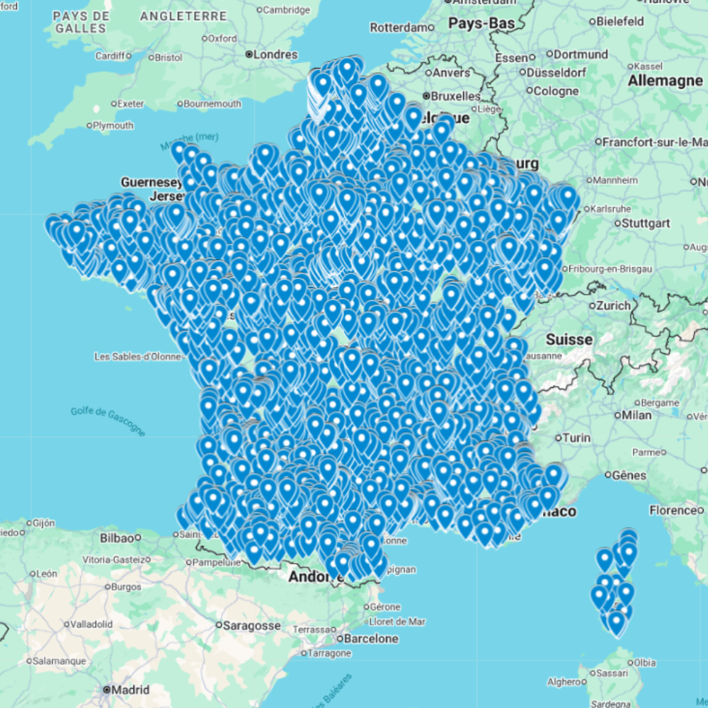
The Urbex Map France is a detailed and structured abandoned places map covering the entire country. It compiles 5,700 verified urban exploration spots into an organized GPS file designed to simplify exploration planning.
Instead of spending hours searching through forums, social networks, or outdated exploration databases, this urban exploration map centralizes valuable location data into a single structured resource. Each entry helps explorers quickly locate abandoned buildings and prepare photography sessions or exploration trips more efficiently.
This urbex map includes a wide variety of urban exploration locations such as industrial sites, former châteaux, abandoned hospitals, forgotten infrastructure, and historic properties. Using this structured GPS map allows explorers to save time, optimize routes, and discover new locations more efficiently.
For urban explorers, photographers, filmmakers, and architecture enthusiasts, having a reliable abandoned places map of France is a major advantage for planning exploration projects and documentary work.
Cities & Regions Included
- Paris & Île-de-France : The Paris region includes abandoned hospitals, office buildings, industrial sites, and former public infrastructures. These locations often provide interesting contrasts between historic architecture and modern urban environments.
- Northern France (Hauts-de-France & Grand Est) : Northern regions include former mining facilities, industrial plants, and military structures. These locations often reflect France’s industrial past and offer impressive large-scale exploration sites.
- Western France (Brittany & Normandy) : Western regions include abandoned coastal structures, old military bunkers, and maritime-related buildings. These locations often combine historical significance with coastal landscapes.
- Southern France (Occitanie & Provence) : Southern France features abandoned hotels, old sanatoriums, rural properties, and forgotten infrastructure. These locations often benefit from unique lighting conditions and historic architecture.
- Rural France : Across the countryside, explorers can find abandoned farmhouses, small schools, manor houses, and isolated structures. These places often provide calm environments where nature gradually reclaims buildings.
Types of Spots Included
This urbex map includes many different types of abandoned locations such as hospitals, factories, warehouses, châteaux, schools, hotels, industrial plants, military structures, office buildings, and transportation infrastructure. Some entries include large industrial complexes, while others focus on smaller historic buildings with architectural or documentary interest. This diversity provides strong opportunities for photography, filming, and exploration documentation.
Why Choose This Urbex Map?
✔️ Verified and organized abandoned locations
✔️ Structured digital GPS format
✔️ Instant access after purchase
✔️ Saves extensive research time
✔️ Large structured database (5,700 spots)
✔️ Designed for serious urban explorers and content creators
Technical Specifications
File Format: .KML / .KMZ
Instant Digital Download
Compatible with Google Earth
Compatible with Google My Maps
Works on Desktop & Mobile Devices
Digital Product Only (No physical item shipped)
How to Install
- Complete your purchase and download the .KML or .KMZ file.
- Open Google Earth or go to Google My Maps in your browser.
- Import the downloaded file into the platform.
- Start browsing the GPS locations and plan your exploration routes.
Installation takes less than two minutes and works on both desktop and mobile platforms.
Responsible Exploration Notice
This product is provided for documentary and informational purposes only. Users are responsible for complying with all applicable local laws and regulations. Always respect private property and restricted areas. Responsible and ethical exploration practices are strongly encouraged.

Reviews
There are no reviews yet.