

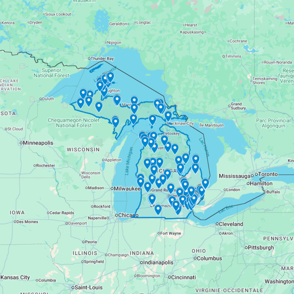
Urbex Map Michigan – 266 Abandoned Places GPS Map
The Urbex Map Michigan is a GPS-ready abandoned places map for urban explorers, photographers, filmmakers, and location researchers. It organizes 266 Michigan abandoned locations into a downloadable KML/KMZ file built for Google Earth and Google My Maps.
Michigan research often mixes Detroit and the metro area, Great Lakes towns, former industrial sites, rural properties, and Upper Peninsula routes. This map gives you a structured starting point for scouting and route planning instead of relying only on scattered forum posts or outdated coordinates.
Use every point as a research lead only. Access, ownership, conditions, and local rules can change, so always verify legality and safety before visiting any abandoned place.
What You Get With This Michigan Urbex Map
- 266 abandoned locations in Michigan organized as GPS map points.
- KML/KMZ digital file for Google Earth and Google My Maps.
- Statewide research coverage: Detroit / Metro Detroit, Great Lakes areas, industrial corridors, rural leads, and Upper Peninsula routes.
- Instant digital download after purchase; no physical product is shipped.
- Useful for urbex planning, photography scouting, documentary research, and responsible exploration preparation.
Cities & Regions Included
- Detroit & Metro Area : Detroit and its metropolitan area contain some of the most iconic abandoned industrial complexes in the world, including former automobile factories, historic mansions, decaying theaters, and vast forgotten urban infrastructure.
- Grand Rapids & West Michigan : Grand Rapids and west Michigan feature abandoned furniture manufacturing plants, former industrial complexes, decaying historic downtown structures, and industrial buildings tied to the region’s furniture and manufacturing heritage.
- Flint & Saginaw Bay Area : Flint and the Saginaw Bay area contain abandoned automotive plants, former industrial facilities, decaying historic commercial districts, and forgotten urban structures reflecting the region’s automotive industry decline.
- Upper Peninsula & Northern Michigan : Michigan’s Upper Peninsula and northern regions feature abandoned copper and iron mines, former logging operations, decaying industrial towns, and isolated wilderness structures set within dramatic Great Lakes landscapes.
Types of Spots Included
This urbex map includes a wide variety of abandoned locations such as hospitals, factories, warehouses, mansions, schools, hotels, industrial plants, office buildings, transportation facilities, and former institutional buildings. Some entries feature large industrial complexes, while others highlight smaller forgotten buildings with historical or architectural significance. The diversity of locations provides excellent opportunities for photography, filming, and urban exploration documentation.
Why Choose This Urbex Map?
✔️ Verified and organized abandoned locations
✔️ Structured digital GPS format
✔️ Instant access after purchase
✔️ Saves extensive research time
✔️ Large structured database (266 spots)
✔️ Designed for serious urban explorers and content creators
Technical Specifications
- File Format: .KML / .KMZ
- Instant Digital Download
- Compatible with Google Earth
- Compatible with Google My Maps
- Works on Desktop & Mobile Devices
- Digital Product Only (No physical item shipped)
How to Install
- Complete your purchase and download the .KML or .KMZ file.
- Open Google Earth or go to Google My Maps in your browser.
- Import the downloaded file into the platform.
- Browse the GPS locations and plan your exploration routes.
Installation takes less than two minutes and works on both desktop and mobile platforms.
Planning a wider USA route? Compare USA urbex maps by state, browse urbex maps by country, or read how to install your urbex map.
Michigan Urbex Map FAQ
Is this Michigan map a GPS file?
Yes. It is a digital KML/KMZ map file for compatible tools such as Google Earth and Google My Maps.
Does it cover more than Detroit?
Yes. The map is intended for statewide Michigan research, including Detroit / Metro Detroit, Great Lakes areas, industrial corridors, rural locations, and Upper Peninsula leads.
Does buying the map give permission to enter abandoned places?
No. The map is a research and planning file, not access permission. Always check ownership, posted restrictions, local laws, and site conditions before any visit.
Reviews
There are no reviews yet.