

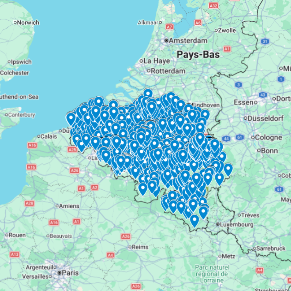
Urbex Map Belgium – Abandoned Places GPS Map
The Urbex Map Belgium is a detailed and structured abandoned places map covering the entire country. It compiles 2,602 verified urban exploration spots into an organized and easy-to-use GPS file format.
What You Get With This Belgium Urbex Map
- 2,602 abandoned places in Belgium prepared as a digital research map.
- GPS/KML/KMZ-ready planning format for Google Earth and Google My Maps style use.
- Useful for abandoned buildings research, urban exploration route planning, photography scouting, and Belgium road trips.
- Instant digital download after purchase; no physical product is shipped.
Use each point as a research lead only. Always verify ownership, posted restrictions, Belgian access rules, current conditions, and safety before visiting any location.
Instead of spending hours searching through outdated forums, scattered coordinates, or unreliable websites, this urban exploration map centralizes all essential data into a structured digital database. Each entry helps you quickly identify abandoned buildings and efficiently plan your exploration routes or photography sessions.
This urbex map includes a wide variety of urban exploration locations such as industrial sites, former public buildings, abandoned castles, and forgotten infrastructure. By using a structured GPS map, you save time and significantly improve your exploration planning.
For urban explorers, photographers, and content creators, having a reliable abandoned places map of Belgium is a major advantage for discovering new locations and organizing exploration projects.
Cities & Regions Included
- Brussels Region : The Brussels area includes abandoned office buildings, former institutional structures, and urban infrastructure. These locations often provide strong contrasts between modern city environments and forgotten spaces.
- Wallonia : Wallonia is known for its industrial heritage, with abandoned factories, steel plants, and mining sites. These locations often offer large-scale industrial environments ideal for exploration and photography.
- Flanders : Flanders includes abandoned warehouses, commercial buildings, and older public infrastructure. The region offers a variety of locations with different architectural styles.
- Rural Belgium : Rural areas feature abandoned farmhouses, manor houses, and isolated buildings. These locations often provide quiet atmospheres with nature gradually reclaiming structures.
Types of Spots Included
This urbex map includes a wide range of abandoned locations such as hospitals, factories, warehouses, castles, mansions, schools, hotels, industrial plants, office buildings, and transportation infrastructure. Some entries include large industrial complexes, while others highlight smaller abandoned buildings with architectural or historical value. This diversity provides strong opportunities for photography, filming, and urban exploration documentation.
Why Choose This Urbex Map?
✔️ Verified and organized abandoned locations
✔️ Structured digital GPS format
✔️ Instant access after purchase
✔️ Saves extensive research time
✔️ Large structured database (2,602 spots)
✔️ Designed for serious urban explorers and content creators
Technical Specifications
- File Format: .KML / .KMZ
- Instant Digital Download
- Compatible with Google Earth
- Compatible with Google My Maps
- Works on Desktop & Mobile Devices
- Digital Product Only (No physical item shipped)
How to Install
- Complete your purchase and download the .KML or .KMZ file.
- Open Google Earth or go to Google My Maps in your browser.
- Import the downloaded file into the platform.
- Start browsing the GPS locations and plan your exploration routes.
Installation takes less than two minutes and works on both desktop and mobile platforms.
Planning a wider European route? Compare more regions from the urbex maps by country hub or browse every digital map in the urbex map shop. New users can also read how to install an urbex map.
Belgium Urbex Map FAQ
Is this Belgium abandoned places map GPS-ready?
Yes. It is a digital map resource designed for GPS/KML-compatible planning tools such as Google Earth and Google My Maps.
Does the map cover abandoned places in Belgium?
Yes. It is positioned for Belgium urban exploration and abandoned places research. Verify every location independently before planning a visit.
Does the map give permission to enter abandoned places?
No. The map is a research and route-planning tool only; it does not grant access rights or permission to enter private, restricted, or unsafe sites.
Reviews
There are no reviews yet.