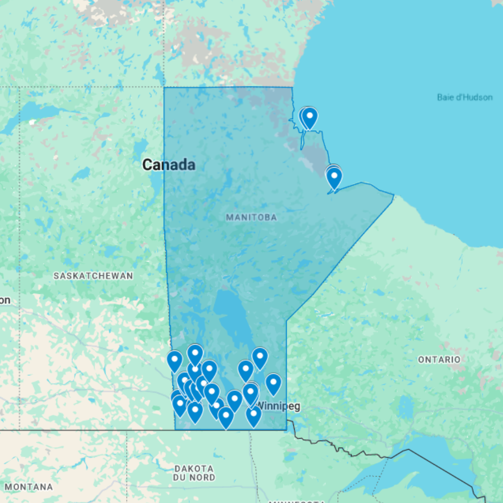
Urbex Map Manitoba – Urban Exploration Canada Map
The Urbex Map Manitoba documents 31 verified GPS locations across the prairie province, from the Exchange District warehouse blocks of Winnipeg to the grain elevator ghost towns of the Red River valley and the remote mining heritage of northern Manitoba. This map covers a province whose abandoned landscape reflects both urban commercial history and prairie agricultural decline.
Manitoba’s abandoned sites are shaped by its unique position at the western gateway of the Canadian prairie settlement: Winnipeg’s Exchange District preserves the physical legacy of the city’s early 20th-century role as the commercial capital of the prairie west, while the surrounding agricultural landscape holds the abandoned infrastructure of wheat farming communities that flourished and then contracted through the 20th century.
Structured for direct import into Google Earth or Google My Maps, this GPS database gives urban explorers and photographers a verified research tool for navigating Manitoba’s abandoned landscape, from Winnipeg’s historic commercial warehouse district to the isolated northern mining heritage.
Cities & Areas Included
- 🏙️ Winnipeg Industrial Heritage & Exchange District : Winnipeg holds a remarkable concentration of former industrial and commercial buildings in the Exchange District, a wholesale warehouse and commercial area built between 1880 and 1920 that contains the largest collection of turn-of-the-century commercial architecture in Canada. Beyond the Exchange District, the city’s North End holds former packing plant and railway infrastructure of considerable scale, while the southwest quadrant preserves decommissioned industrial complexes from the city’s post-war manufacturing expansion.
- 🌾 Prairie Homesteading Towns & Grain Heritage : Manitoba’s prairie landscape holds former homesteading communities, decommissioned grain elevator complexes, and abandoned railway infrastructure across the province’s agricultural south. The Red River valley and Interlake region add former flour mill infrastructure, abandoned Ukrainian heritage buildings from the province’s early 20th-century settlement era, and forgotten farm complexes that reflect Manitoba’s diverse immigrant agricultural communities.
Types of Spots Included
This urbex map covers Winnipeg’s former Exchange District commercial and warehouse buildings, decommissioned North End packing plant and railway infrastructure, prairie grain elevator complexes and homesteading community remnants across southern Manitoba, former Ukrainian and Eastern European immigrant heritage farmsteads in the Interlake and eastern regions, and decommissioned northern Manitoba mining infrastructure. Manitoba’s Exchange District represents the most intact collection of early 20th-century commercial architecture anywhere in western Canada.
Why Choose This Urbex Map?
- 31 verified locations compiled into one GPS database
- Compatible with Google Earth and Google My Maps
- Instant download, no waiting, no shipping
- Replaces hours of scattered research with one organized file
- Trusted by urbexers, photographers, and documentary crews
- Structured for both solo exploration and professional projects
Technical Specifications
- File Format: .KML / .KMZ
- Instant Digital Download
- Compatible with Google Earth
- Compatible with Google My Maps
- Works on Desktop & Mobile Devices
- Digital Product Only (No physical item shipped)
How to Install
- Complete your purchase and download the .KML or .KMZ file.
- Open Google Earth or go to Google My Maps in your browser.
- Import the downloaded file into the platform.
- Browse the GPS locations and plan your exploration routes.
Installation takes less than two minutes and works on both desktop and mobile platforms.
Reviews
There are no reviews yet.