

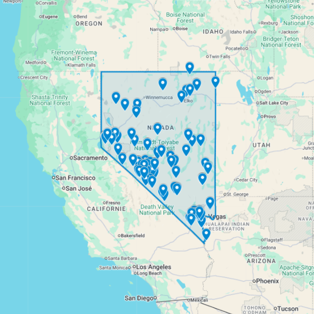
Urbex Map Nevada – 127 Abandoned Places GPS Map
The Urbex Map Nevada brings together 127 verified GPS locations distributed across the state’s most historically significant regions. Whether you’re searching for urbex near me or planning a multi-day route, this map gives you direct access to structured, ready-to-use coordinates.
From the resort facilities of Las Vegas to the casino facilities of Reno and the silver mining operations found throughout Carson City, this map covers the full spectrum of abandoned places that Nevada has to offer.
Every listed location is organized into a structured GPS file, giving photographers, filmmakers, and urban explorers reliable coordinates and a direct research advantage when planning routes or documentation projects anywhere in Nevada.
Cities & Regions Included
- Las Vegas & Southern Nevada : Las Vegas and southern Nevada contain abandoned resort facilities, former commercial complexes, decaying industrial structures, and forgotten buildings shaped by the region’s entertainment-driven development and rapid economic cycles.
- Reno & Northern Nevada : Reno and northern Nevada feature abandoned casino facilities, former Comstock Lode-era mining infrastructure, decaying historic commercial districts, and industrial buildings tied to the region’s mining and gaming heritage.
- Carson City & Historic Mining Towns : Carson City and the surrounding region include abandoned silver mining operations, former state facilities, decaying historic commercial properties, and ghost towns reflecting Nevada’s 19th-century mining boom heritage.
- Rural Nevada & Desert Outposts : Rural Nevada features some of the best-preserved ghost towns in the American West, with abandoned mining camps, former railroad towns, and isolated desert structures set within dramatic Nevada desert landscapes.
Types of Spots Included
This urbex map documents a variety of abandoned locations specific to Nevada, including resort facilities, commercial complexes, industrial structures, casino facilities, and other forgotten structures of historical and architectural interest. Additional entries cover comstock lode-era mining infrastructure and historic commercial districts, reflecting the depth of Nevada’s abandoned landscape. The range of sites across the state creates strong opportunities for urbex photography, film scouting, and documentary documentation.
Why Choose This Urbex Map?
- 127 verified locations compiled into one GPS database
- Compatible with Google Earth and Google My Maps
- Instant download – no waiting, no shipping
- Replaces hours of scattered research with one organized file
- Trusted by urbexers, photographers, and filmmakers
- Structured for both solo exploration and professional projects
Technical Specifications
- File Format: .KML / .KMZ
- Instant Digital Download
- Compatible with Google Earth
- Compatible with Google My Maps
- Works on Desktop & Mobile Devices
- Digital Product Only (No physical item shipped)
How to Install
- Complete your purchase and download the .KML or .KMZ file.
- Open Google Earth or go to Google My Maps in your browser.
- Import the downloaded file into the platform.
- Browse the GPS locations and plan your exploration routes.
Installation takes less than two minutes and works on both desktop and mobile platforms.
Planning a wider route? Compare nearby states on the USA urbex map by state, browse the full urbex map shop, or read how to install your urbex map.
Nevada Urbex Map FAQ
Is this Nevada abandoned places map GPS-ready?
Yes. It is a digital urbex map designed for GPS/KMZ-compatible planning tools such as Google Earth and Google My Maps.
Does it include abandoned places in Nevada?
Yes. The existing product data lists 127 Nevada abandoned locations. Check each location independently before planning a route.
Does the map give permission to enter sites?
No. The map is a research and route-planning aid only; it does not grant access rights or permission to enter private, restricted or unsafe places.

Reviews
There are no reviews yet.