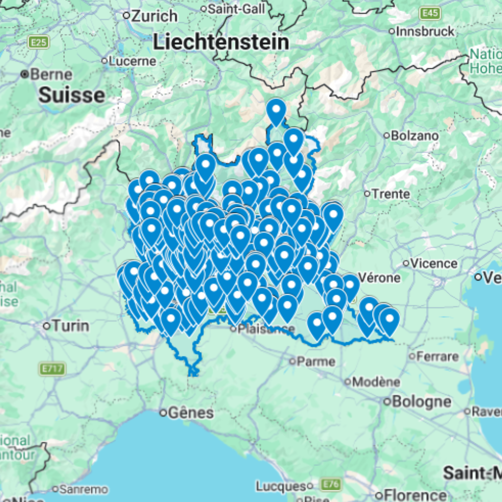
Urbex Map Lombardia – Urban Exploration Italy Map
The Urbex Map Lombardia compiles 565 verified GPS locations across Italy’s most populated and industrially dense region. From the abandoned manufacturing belt surrounding Milan to the former steelworks of Brescia and the decommissioned textile mills of Como and Bergamo, this map covers the full geographic range of Lombardy’s extraordinary abandoned heritage.
Lombardy’s rapid deindustrialisation between the 1970s and 1990s produced one of Europe’s highest concentrations of abandoned industrial sites in a single region. Former Falck steelworks in Sesto San Giovanni, sprawling decommissioned factories north of Milan, and disused psychiatric hospitals across the province stand as some of the most visited urbex destinations in Italy, all captured here with verified GPS coordinates.
This database is structured for direct import into Google Earth or Google My Maps, giving photographers, filmmakers, and serious urban explorers the navigational foundation to cover Lombardy’s abandoned landscape without hours of preliminary research across scattered forums and private databases.
Cities & Areas Included
- 🏭 Milan & the Metropolitan Industrial Belt : Milan is the largest single urbex territory in Italy, with over 130 documented abandoned sites across its metropolitan area: former textile mills along the Navigli canals, decommissioned manufacturing complexes in the north-eastern fringe, and abandoned psychiatric institutions that draw explorers from across Europe. The Sesto San Giovanni corridor, once nicknamed the “Italian Ruhr”, preserves the remains of the former Falck steelworks, one of the most photographed industrial ruins in the country.
- ⚙️ Brescia, Bergamo & Eastern Lombardy : Brescia (around 49 sites) and Bergamo (around 41 sites) represent Lombardy’s traditional industrial heartland: former arms manufacturing facilities, decommissioned foundries, and abandoned commercial buildings reflecting a century of heavy industry. The lower Bergamo valleys add former cotton mills and hydroelectric infrastructure, while the lakeside areas around Como and Lecco offer abandoned villas and defunct textile plants set against Alpine backdrops.
- 🌿 Pavia, Cremona & the Po Plain : South of Milan, the Po Plain holds former agricultural processing plants, abandoned rice paddies infrastructure, and forgotten rural estates across the provinces of Pavia, Cremona, and Mantova. Smaller in scale than the metropolitan sites, these locations compensate with exceptional states of preservation, some agro-industrial buildings untouched since the 1970s and rich in original equipment, signage, and documentary detail.
Types of Spots Included
This urbex map documents former textile and garment factories across Milan’s metropolitan area, decommissioned steelworks and foundries in the Sesto San Giovanni–Brescia–Bergamo corridor, abandoned psychiatric hospitals, disused hydroelectric stations along the Alpine pre-foothills, and forgotten agro-industrial facilities across the Po Plain. Lombardy’s combination of volume, site variety, and photographic quality makes it the single most productive urbex region in Italy.
Why Choose This Urbex Map?
- ✔️ 565 verified and organized abandoned locations
- ✔️ Structured digital GPS format (.KML / .KMZ)
- ✔️ Instant access after purchase
- ✔️ Saves extensive research time
- ✔️ Compatible with Google Earth and Google My Maps
- ✔️ Designed for serious urban explorers and content creators
Technical Specifications
- File Format: .KML / .KMZ
- Instant Digital Download
- Compatible with Google Earth
- Compatible with Google My Maps
- Works on Desktop & Mobile Devices
- Digital Product Only (No physical item shipped)
How to Install
- Complete your purchase and download the .KML or .KMZ file.
- Open Google Earth or go to Google My Maps in your browser.
- Import the downloaded file into the platform.
- Browse the GPS locations and plan your exploration routes.
Installation takes less than two minutes and works on both desktop and mobile platforms.
Reviews
There are no reviews yet.