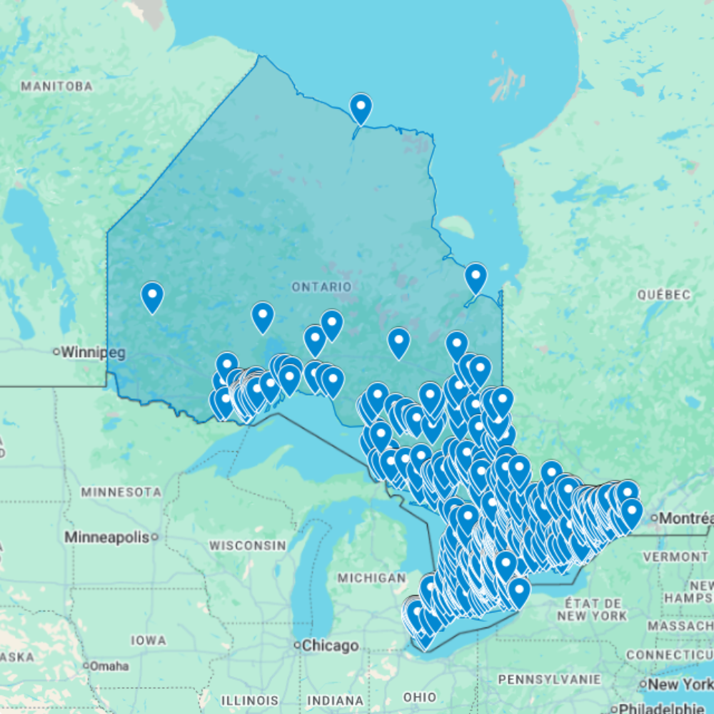
Urbex Map Ontario – Urban Exploration Canada Map
The Urbex Map Ontario compiles 1513 verified GPS locations across Canada’s most urbanised and industrially complex province. From the waterfront ruins of Toronto’s Port Lands to the former steel infrastructure of Hamilton, the abandoned mine headframes of northern Ontario, and the decommissioned institutional buildings of Ottawa, this map covers the full geographic and typological range of Ontario’s abandoned landscape.
Ontario’s abandoned sites reflect over a century of industrial boom and contraction: the rise and fall of the Great Lakes steel industry, the collapse of resource extraction towns across the Canadian Shield, and the successive waves of deindustrialisation that transformed Toronto, Hamilton, and Windsor from manufacturing powerhouses into post-industrial landscapes. Each phase left behind distinct categories of abandonment, from Victorian-era asylum complexes to mid-century automobile plants to Cold War-era military infrastructure.
Structured for direct import into Google Earth or Google My Maps, this GPS database gives urban explorers, photographers, and documentary crews a verified research foundation for navigating the largest and most diverse abandoned landscape in Canada.
Cities & Areas Included
- 🏭 Toronto & the Greater Toronto Industrial Belt : Toronto and its metropolitan area hold the largest concentration of abandoned sites in Canada: former manufacturing plants along the waterfront, decommissioned industrial complexes in the east end, and forgotten institutional buildings across the city’s sprawling suburban fringe. The Port Lands industrial peninsula, once a major hub of Canadian manufacturing, preserves some of the most photographically compelling industrial ruins in the country, while the Don Valley corridor adds former brickworks, asylums, and infrastructure of extraordinary historical scale.
- 🔩 Hamilton, Niagara & the Steel Belt : Hamilton holds some of Canada’s most dramatic abandoned industrial infrastructure: former Stelco and Dofasco steel plant ancillary buildings, decommissioned port facilities along Burlington Bay, and forgotten industrial complexes from Canada’s heavy manufacturing era. The Niagara region adds former canal infrastructure, abandoned textile mills, and decommissioned institutional buildings set against the distinctive landscape of the Niagara Escarpment.
- ⛏️ Northern Ontario Mining & Wilderness : Northern Ontario holds abandoned mine headframes, former company towns, and decommissioned railway infrastructure across a vast boreal wilderness that stretches from Sudbury to Thunder Bay and beyond. The Silver Belt around Cobalt, the Porcupine Gold Camp near Timmins, and the iron ore infrastructure of the Steep Rock area represent extraordinary concentrations of industrial archaeology that remain largely unexplored by the wider urbex community.
Types of Spots Included
This urbex map covers Toronto’s former waterfront manufacturing plants and industrial infrastructure, Hamilton’s decommissioned steel plant ancillary buildings and port facilities, abandoned asylum and psychiatric hospital complexes across the province, former mine headframes and company towns on the Canadian Shield, decommissioned railway infrastructure and roundhouses, and forgotten rural industrial buildings across the Ontario countryside. Ontario’s combination of urban industrial heritage, institutional ruins, and wilderness mining sites makes it the single richest urbex province in Canada.
Why Choose This Urbex Map?
✔️ 1513 verified and organized abandoned locations
✔️ Structured digital GPS format (.KML / .KMZ)
✔️ Instant access after purchase
✔️ Saves extensive research time
✔️ Compatible with Google Earth and Google My Maps
✔️ Designed for serious urban explorers and content creators
Technical Specifications
- File Format: .KML / .KMZ
- Instant Digital Download
- Compatible with Google Earth
- Compatible with Google My Maps
- Works on Desktop & Mobile Devices
- Digital Product Only (No physical item shipped)
How to Install
- Complete your purchase and download the .KML or .KMZ file.
- Open Google Earth or go to Google My Maps in your browser.
- Import the downloaded file into the platform.
- Browse the GPS locations and plan your exploration routes.
Installation takes less than two minutes and works on both desktop and mobile platforms.
Reviews
There are no reviews yet.