

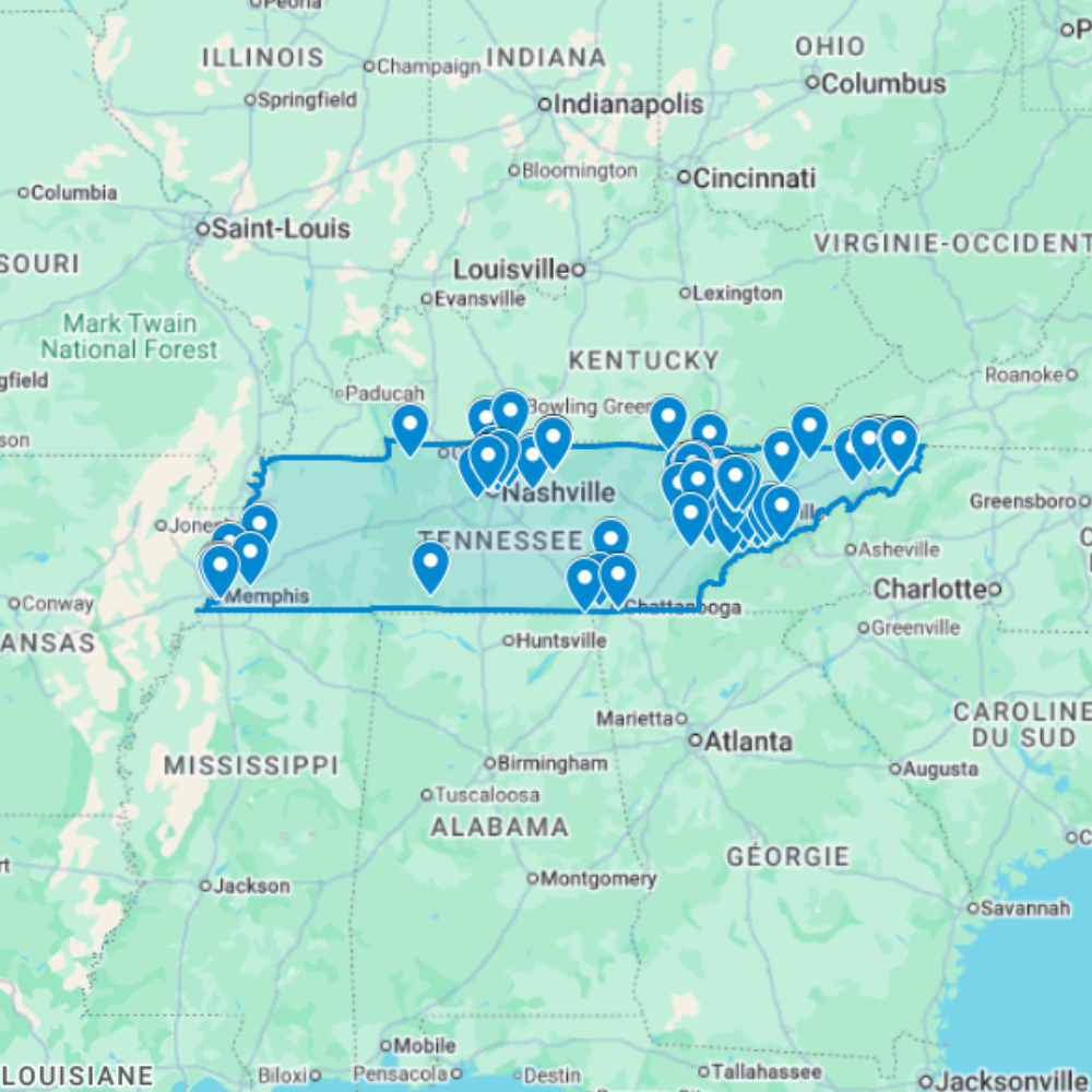
Urbex Map Tennessee – 102 Abandoned Places GPS Map
The Urbex Map Tennessee is a downloadable digital map for abandoned places research across Tennessee, USA. It includes 102 abandoned locations organized as a GPS-ready planning resource for Google Earth, KMZ-compatible apps, and Google My Maps style route preparation.
This product is built for searches like urbex map Tennessee, abandoned places Tennessee map, and urban exploration Tennessee map: a state-level map for planning routes, photography scouting, and location research without relying only on scattered blogs or forum posts.
What You Get With This Tennessee Urbex Map
- 102 abandoned locations in Tennessee compiled into one structured digital map resource.
- GPS/KMZ-style planning format for Google Earth and Google My Maps workflows.
- Statewide research coverage for Nashville, Memphis, Knoxville, Chattanooga, rural routes, industrial corridors, mountain areas, and forgotten infrastructure.
- Useful for urban exploration research, photography scouting, documentary planning, and responsible route preparation.
- Instant digital download after purchase; no physical product is shipped.
Every point should be treated as a planning lead only. Always verify ownership, posted restrictions, local trespassing rules, access conditions, and safety risks before visiting any location.
Cities & Regions Included
- Nashville & Middle Tennessee : Nashville and middle Tennessee contain abandoned industrial facilities, former recording industry-adjacent buildings, decaying historic neighborhoods, and forgotten structures shaped by the city’s music industry and broader commercial heritage.
- Memphis & West Tennessee : Memphis and west Tennessee feature former industrial complexes, abandoned historic commercial buildings, decaying neighborhoods, and forgotten structures reflecting the city’s blues music heritage and Mississippi River industrial history.
- Knoxville & East Tennessee : Knoxville and east Tennessee include abandoned manufacturing facilities, former TVA-related infrastructure, decaying historic commercial districts, and industrial buildings tied to the region’s Appalachian industrial heritage.
- Rural Tennessee & Small Towns : Rural Tennessee and smaller towns feature abandoned farmsteads, former small industrial operations, decaying historic community centers, and rural structures across the diverse landscapes of Middle and East Tennessee.
Types of Spots Included
This urbex map includes a wide variety of abandoned locations such as hospitals, factories, warehouses, mansions, schools, hotels, industrial plants, office buildings, transportation facilities, and former institutional buildings. Some entries feature large industrial complexes, while others highlight smaller forgotten buildings with historical or architectural significance. The diversity of locations provides excellent opportunities for photography, filming, and urban exploration documentation.
Why Choose This Urbex Map?
✔️ Verified and organized abandoned locations
✔️ Structured digital GPS format
✔️ Instant access after purchase
✔️ Saves extensive research time
✔️ Large structured database (72 spots)
✔️ Designed for serious urban explorers and content creators
Technical Specifications
- File Format: .KML / .KMZ
- Instant Digital Download
- Compatible with Google Earth
- Compatible with Google My Maps
- Works on Desktop & Mobile Devices
- Digital Product Only (No physical item shipped)
How to Install
- Complete your purchase and download the .KML or .KMZ file.
- Open Google Earth or go to Google My Maps in your browser.
- Import the downloaded file into the platform.
- Browse the GPS locations and plan your exploration routes.
Installation takes less than two minutes and works on both desktop and mobile platforms.

Reviews
There are no reviews yet.