Urbex Map Oklahoma – Urban Exploration USA Map
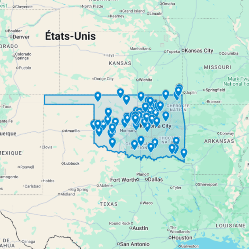
The Urbex Map Oklahoma brings together 64 verified GPS locations distributed across the state’s most historically significant regions. Whether you’re searching for urbex near me or planning a multi-day route, this map gives you direct access to structured, ready-to-use coordinates.
From the industrial facilities of Oklahoma City to the oil refinery facilities of Tulsa and the military-adjacent facilities found throughout Lawton, this map covers the full spectrum of abandoned places that Oklahoma has to offer.
Every listed location is organized into a structured GPS file, giving photographers, filmmakers, and urban explorers reliable coordinates and a direct research advantage when planning routes or documentation projects anywhere in Oklahoma.
Cities & Regions Included
- Oklahoma City & Metro Area : Oklahoma City and surrounding areas contain abandoned industrial facilities, former oil industry infrastructure, decaying historic commercial districts, and forgotten buildings shaped by the state’s oil boom and bust economic cycles.
- Tulsa & Green Country : Tulsa and the Green Country region feature former oil refinery facilities, abandoned Art Deco commercial buildings, decaying historic neighborhoods, and industrial structures tied to the region’s significant petroleum heritage.
- Lawton & Southwest Oklahoma : Lawton and southwest Oklahoma include abandoned military-adjacent facilities, former small industrial operations, decaying historic commercial districts, and rural structures reflecting the region’s ranching and military heritage.
- Rural Oklahoma & Panhandle : Rural Oklahoma and the Panhandle feature abandoned homesteads, Dust Bowl-era ghost towns, former ranch operations, and isolated agricultural structures set across the vast open landscapes of the southern Great Plains.
Types of Spots Included
This urbex map documents a variety of abandoned locations specific to Oklahoma, including industrial facilities, oil industry infrastructure, historic commercial districts, oil refinery facilities, and other forgotten structures of historical and architectural interest. Additional entries cover art deco commercial buildings and historic neighborhoods, reflecting the depth of Oklahoma’s abandoned landscape. The range of sites across the state creates strong opportunities for urbex photography, film scouting, and documentary documentation.
Why Choose This Urbex Map?
- 📍 64 GPS-ready locations in one organized file
- 📡 Direct import to Google Earth and Google My Maps
- ⚡ Available immediately after purchase
- ⏱️ Skip hours of online research with a single download
- 🎯 Built for serious field explorers and content creators
- 📷 Ideal for photography routes, film scouting, and visual documentation
Technical Specifications
- File Format: .KML / .KMZ
- Instant Digital Download
- Compatible with Google Earth
- Compatible with Google My Maps
- Works on Desktop & Mobile Devices
- Digital Product Only (No physical item shipped)
How to Install
- Complete your purchase and download the .KML or .KMZ file.
- Open Google Earth or go to Google My Maps in your browser.
- Import the downloaded file into the platform.
- Browse the GPS locations and plan your exploration routes.
Installation takes less than two minutes and works on both desktop and mobile platforms.
Reviews
There are no reviews yet.