Urbex Map Hamburg – Urban Exploration Germany Map
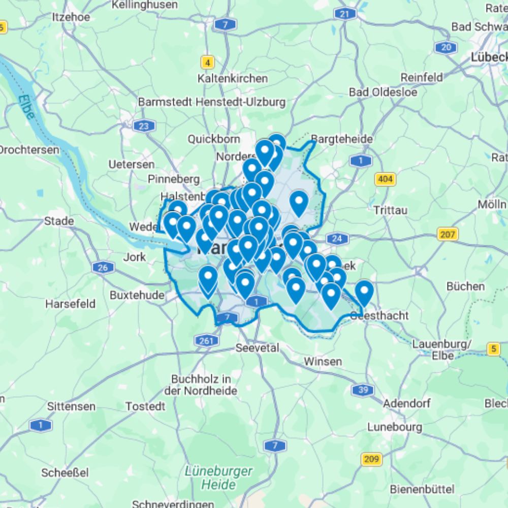
The Urbex Map Hamburg is a detailed and structured abandoned places map covering the entire federal state of Hamburg. It compiles 74 verified urban exploration spots into a practical and easy-to-use GPS file format.
Instead of spending hours searching through outdated forums, scattered coordinates, or unreliable online sources, this urban exploration map centralises essential location data into one organised digital database. Each entry helps explorers quickly identify potential abandoned buildings and plan photography sessions or exploration routes efficiently.
This urbex map includes a wide range of urban exploration spots such as industrial sites, former public buildings, forgotten infrastructure, and historic properties. By using a structured GPS map, explorers can significantly reduce research time and organise their exploration routes more effectively.
For urban explorers, photographers, filmmakers, and content creators, having a reliable abandoned places map of Hamburg provides a valuable advantage for planning documentary work and visual storytelling.
Cities & Regions Included
- 🚢 Hamburg Harbour & Speicherstadt : Hamburg’s harbour and the historic Speicherstadt warehouse district contain some of Germany’s most iconic abandoned and repurposed industrial structures. Former dockside facilities, warehouses, and shipbuilding infrastructure create a unique urban exploration landscape.
- 🏭 Altona & Western Industrial Districts : Altona and Hamburg’s western industrial zones feature abandoned fish processing plants, former factory buildings, decaying waterfront industrial complexes, and forgotten structures shaped by the city’s historic working-class industrial neighbourhoods.
- 🏙️ Eastern Harbour & Wilhelmsburg : Hamburg’s eastern harbour and Wilhelmsburg island contain abandoned dockland facilities, former industrial warehouses, decaying port structures, and forgotten zones shaped by Hamburg’s long history as one of Europe’s busiest trading ports.
- 🌿 Northern Hamburg & Outer Boroughs : Hamburg’s northern outskirts and outer boroughs offer abandoned suburban commercial buildings, former light industrial facilities, decaying infrastructure, and isolated structures set at the edges of the city’s expanding residential development.
Types of Spots Included
This urbex map includes a wide variety of abandoned locations such as former factories, hospitals, warehouses, industrial plants, schools, hotels, military facilities, office buildings, GDR-era structures, and historic institutional buildings. Some entries feature large industrial complexes, while others highlight smaller forgotten buildings with historical or architectural significance. The diversity of locations provides excellent opportunities for photography, filming, and urban exploration documentation.
Why Choose This Urbex Map?
✔️ Verified and organised abandoned locations
✔️ Structured digital GPS format
✔️ Instant access after purchase
✔️ Saves extensive research time
✔️ Large structured database (74 spots)
✔️ Designed for serious urban explorers and content creators
Technical Specifications
- File Format: .KML / .KMZ
- Instant Digital Download
- Compatible with Google Earth
- Compatible with Google My Maps
- Works on Desktop & Mobile Devices
- Digital Product Only (No physical item shipped)
How to Install
- Complete your purchase and download the .KML or .KMZ file.
- Open Google Earth or go to Google My Maps in your browser.
- Import the downloaded file into the platform.
- Browse the GPS locations and plan your exploration routes.
Installation takes less than two minutes and works on both desktop and mobile platforms.
Reviews
There are no reviews yet.