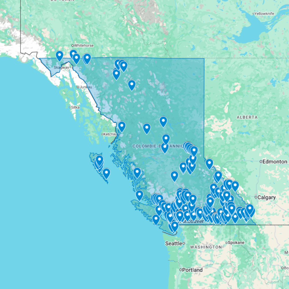
Urbex Map British Columbia – Urban Exploration Canada Map
The Urbex Map British Columbia documents 192 verified locations across one of Canada’s most topographically dramatic abandoned landscapes. From the silver mining ghost towns of the Kootenays to the former canneries of the BC coast and the decommissioned industrial waterfronts of Vancouver, this map gives explorers GPS access to a province where abandoned sites are set against some of North America’s most extraordinary natural scenery.
BC’s abandoned landscape is defined above all by the boom-and-bust cycle of resource extraction: silver and gold mining in the late 19th and early 20th centuries created entire communities that were subsequently emptied when mineral prices collapsed, leaving behind ghost towns in spectacular mountain settings. The same cycle played out later with salmon canning, coastal logging, and copper mining, each phase producing a distinct category of abandonment across the province’s varied terrain.
Structured for direct import into Google Earth or Google My Maps, this database gives urban explorers, photographers, and filmmakers a verified GPS foundation for navigating BC’s scattered and often remote abandoned sites, from coastal fishing stations accessible by boat to mountain mine headframes reachable only by four-wheel drive.
Cities & Areas Included
- ⛏️ Interior BC, Mining Ghost Towns : British Columbia’s interior holds one of the highest concentrations of mining ghost towns in North America: former silver and gold extraction communities across the Boundary Country, the Kootenays, and the Cariboo, towns like Sandon, Phoenix, Bralorne, and Retallack that boomed in the late 19th century and were largely empty by the mid-20th. Some sites preserve entire commercial streets, mine headframes, concentrator mills, and workers’ housing in states of spectacular decay, set against BC’s dramatic mountain and valley landscapes.
- 🌊 Vancouver, the Lower Mainland & Coastal Industry : Vancouver and its surrounding area hold former industrial waterfront complexes, decommissioned grain elevator infrastructure, and abandoned canneries along the Fraser River estuary. The North Shore adds former lumber mill sites, while the eastern suburbs contribute forgotten industrial buildings from the post-war manufacturing expansion. The BC coast holds abandoned salmon canneries, particularly on the Skeena and Nass rivers, that represent a vanished coastal processing industry of considerable architectural and historical significance.
- 🌲 Logging Camps, Sawmills & Remote Sites : BC’s interior and north hold former logging camps, decommissioned sawmill complexes, and isolated industrial sites deep within the boreal and coastal forests. Some camp sites, accessible only by logging road or floatplane, preserve bunkhouse complexes, equipment sheds, and portable sawmill infrastructure in exceptional states of isolation. The Kootenay and Okanagan regions add former fruit packing plants and agricultural processing facilities from the province’s orchard industry heritage.
Types of Spots Included
This urbex map covers BC’s interior mining ghost towns and former extraction communities across the Kootenays, Boundary Country, and Cariboo regions, abandoned salmon canneries and coastal fishing infrastructure along the Skeena and Fraser river systems, former sawmill complexes and logging camp infrastructure in the coastal and interior forests, decommissioned Vancouver waterfront industrial buildings and grain elevator infrastructure, and former orchard packing houses and agricultural processing facilities in the Okanagan and Kootenay valleys.
Why Choose This Urbex Map?
- 192 verified locations compiled into one GPS database
- Compatible with Google Earth and Google My Maps
- Instant download, no waiting, no shipping
- Replaces hours of scattered research with one organized file
- Trusted by urbexers, photographers, and documentary crews
- Structured for both solo exploration and professional projects
Technical Specifications
- File Format: .KML / .KMZ
- Instant Digital Download
- Compatible with Google Earth
- Compatible with Google My Maps
- Works on Desktop & Mobile Devices
- Digital Product Only (No physical item shipped)
How to Install
- Complete your purchase and download the .KML or .KMZ file.
- Open Google Earth or go to Google My Maps in your browser.
- Import the downloaded file into the platform.
- Browse the GPS locations and plan your exploration routes.
Installation takes less than two minutes and works on both desktop and mobile platforms.
Reviews
There are no reviews yet.