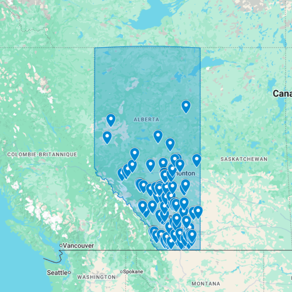
Urbex Map Alberta – Urban Exploration Canada Map
The Urbex Map Alberta documents 118 verified GPS locations across the prairie province, from the grain elevator ghost towns of the southern plains to the former coal mining infrastructure of the Crowsnest Pass and the decommissioned industrial complexes of Edmonton. This map covers a province where abandonment often takes the form of entire communities rather than individual buildings.
Alberta’s abandoned landscape reflects the province’s sequential resource extraction economies: the wheat homesteading era that populated hundreds of small railway towns across the prairies, the coal mining period that built communities in the Foothills and Crowsnest Pass, and the early petroleum industry whose legacy of decommissioned pump jacks, abandoned service towns, and forgotten infrastructure dots the landscape between Calgary and the Saskatchewan border.
Structured for direct import into Google Earth or Google My Maps, this GPS database gives urban explorers, photographers, and documentary crews a verified research tool for navigating Alberta’s abandoned landscape, from the atmospheric grain elevator ghost towns of the prairie south to the former coal extraction infrastructure of the Rocky Mountain foothills.
Cities & Areas Included
- 🌾 Prairie Ghost Towns & Grain Elevator Heritage : Alberta’s prairies hold hundreds of former homesteading communities, tiny railway towns that flourished during the wheat boom of the early 20th century and gradually emptied as agriculture mechanised and populations moved to larger centres. Many of these communities retain their original grain elevators, wooden false-front commercial buildings, and abandoned farmsteads in states of arrested decay across the flat prairie landscape. The wooden grain elevator, once a symbol of Canadian prairie settlement, is now one of the province’s most photographed categories of industrial ruin.
- 🏭 Edmonton Industrial Heritage & Institutional Sites : Edmonton holds former industrial complexes from the city’s post-war manufacturing expansion, decommissioned institutional buildings including former hospital and asylum infrastructure, and abandoned railway yards and repair facilities. The North Saskatchewan River valley adds former brickworks, decommissioned utility infrastructure, and forgotten industrial buildings that once supported the city’s growth. Some of Edmonton’s former psychiatric facilities, built during the early 20th century on a sprawling estate model, remain standing and largely intact.
- ⛏️ Coal Mining & Crowsnest Pass Heritage : The Crowsnest Pass along Alberta’s southwestern border holds some of the most significant abandoned coal mining infrastructure in western Canada: former mine openings, tipples, coke oven banks, and company housing from communities like Blairmore, Bellevue, and Hillcrest. The Frank Slide historic site and its surrounding area preserve the physical evidence of early 20th-century coal extraction on a dramatic scale, while the Drumheller Badlands region adds former coal mining infrastructure set against one of the most visually striking landscapes in the country.
Types of Spots Included
This urbex map covers prairie ghost towns and former homesteading communities across the Alberta plains, wooden grain elevators and railway-era commercial buildings along former CN and CP branch lines, coal mine infrastructure and coke oven banks in the Crowsnest Pass and Drumheller regions, former Edmonton institutional buildings and psychiatric facility complexes, abandoned farmsteads and agricultural processing infrastructure, and early petroleum industry equipment and service town buildings across central and southern Alberta.
Why Choose This Urbex Map?
- ✔️ 118 verified and organized abandoned locations
- ✔️ Structured digital GPS format (.KML / .KMZ)
- ✔️ Instant access after purchase
- ✔️ Saves extensive research time
- ✔️ Compatible with Google Earth and Google My Maps
- ✔️ Designed for serious urban explorers and content creators
Technical Specifications
- Format: .KML / .KMZ (GPS file)
- Access: Instant digital download
- Platforms: Google Earth, Google My Maps
- Devices: Desktop and mobile compatible
- Delivery: Digital file, no physical shipment
- Compatibility: Works on all major operating systems
How to Install
- Purchase and download your .KML or .KMZ file immediately after checkout.
- Launch Google Earth on your device, or open Google My Maps in any browser.
- Use the import or open file option to load the GPS file into the platform.
- Navigate through the mapped locations and start building your exploration plan.
The entire setup process takes under two minutes and is compatible with both desktop and mobile devices.
Reviews
There are no reviews yet.